

| Distance (km) | Ascent (metres) | Number of days | |
|---|---|---|---|
| 161 | 1110 | 6 - 9 | |
| Start: Glenapp Kirk | Finish: Skelmorlie | ||
|
Linked to other Scotland’s Great Trail(s): Mull of Galloway Trail River Ayr Way |
|||
Books
Below we list printed maps and/or guidebooks in ascending order of cover price: click image or title for more info. To add or alter any items in this list, please Contact us.
Route type/direction
Linear: Glenapp Kirk to Skelmorlie
The route is better walked south to north, because this gives better views and puts the prevailing wind behind you.
Overview
The Rotary Club of Ayr created this trail and maintains it on a voluntary basis. It links with the Mull of Galloway Trail in the south and the Clyde Coastal Path in the north to form the 135-mile Firth o Clyde Rotary Trail (Mull of Galloway to Milngavie), created by the Rotary Clubs of Stranraer, Ayr, Gourock and Allander. This links into the Scottish section of the International Appalachian Trail from the Mull of Galloway to Cape Wrath.
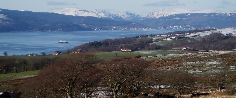
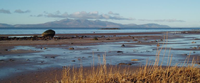
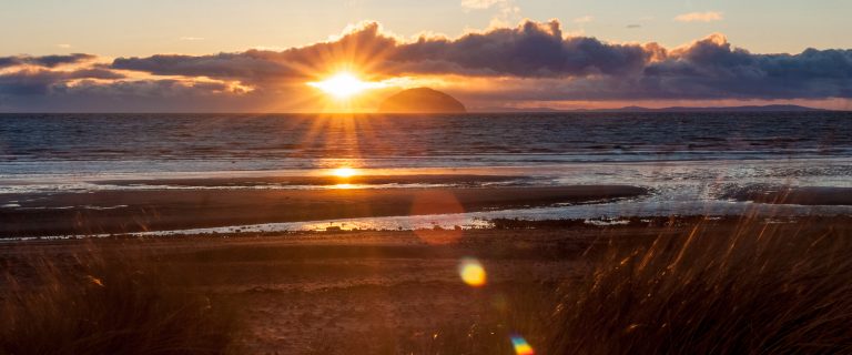
On the sections from Glenapp to Girvan, Culzean Bay to Ayr, and north of Largs, certain parts of the terrain can be rough, but spectacular, incorporating hill and clifftop tracks, and rocky shores. In contrast, the sweeping Ayr and Irvine Bays provide a pleasant and varied beach walk from Girvan to Largs over almost two-thirds of the entire route. Featuring memorable views of Ailsa Craig and Arran, the route is rich in superb coastal scenery and biodiversity.
Highlights
- spectacular views of the Firth of Clyde and its islands, also to Kintyre and Ireland
- many historic castles, including Culzean, Dunure, Dundonald and Kelburn
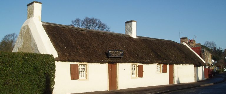
- Robert Burns Birthplace Museum at Alloway (via a 2.4-mile/3.9-km detour)
- superb wildlife, including basking sharks, otters, seals and 135 species of birds
- Maritime Museum in Irvine
- interesting geology and wide range of wildflowers in spring/summer
- Vikingar in Largs
Be aware
- variable terrain, some of which will be unsuited to some categories of user
- in places, high tides can prevent safe passage for short periods
- limited facilities on-route in some of the wilder southern sections
- sensitive farmland areas with livestock; dogs must be under strict control
The challenge
Especially in the south, with many stretches along cliff-tops, up and down gullies and over rough rocky shores, the trail is suited to well-equipped, agile walkers. There are several short (150-300 m) sections that require scrambling over rocky shorelines (between Girvan and Turnberry, Culzean and Dunure, Dunure and Ayr). Normally walkable at most states of the tide, these may be impassable for 1-2 hours before and after certain high tides (on 3-5 days each month). On either side of Dunure there are short but very steep climbs, assisted by a series of wooden-sleeper steps.
Waymarkers are frequent and there are otherwise very few steep hill climbs, so it is not a daunting route. It includes many sections of 6-8 miles (10-14 km) which are ideal for moderately fit walkers and cyclists. Also, from Ayr to Largs most of the route is flat, along sandy beaches, cycleways and pleasant promenades, suitable for all abilities including wheelchair users.
Accommodation
The Ayrshire coast is a traditional holiday destination and coastal villages or towns are seldom more than five to eight miles apart. There is a wide choice of accommodation, ranging from B&Bs and self-catering to five-star hotels. There are also caravan and camping sites at convenient intervals. Visit the official website for listings.
Wild camping is legal in Scotland subject to the Scottish Outdoor Access Code.
Support services
We don’t know of any dedicated to this route., although many B&B hosts offer baggage transfer and lifts to their walking guests. There are also plenty of local taxi firms.
Public transport
Glasgow Prestwick airport is at Prestwick, about 33 miles from Glasgow, but very close to the route.
Scotrail trains from Glasgow Central to Stranraer cover coastal towns south of Kilwinning, with a branch service from Kilwinning up to Largs. The service from Glasgow Central to Wemyss Bay covers the northern part of the route. Stagecoach provides regular services to all towns and villages along the Ayrshire Coastal Path, which between Glenapp and Skelmorlie runs close to bus routes and railway.
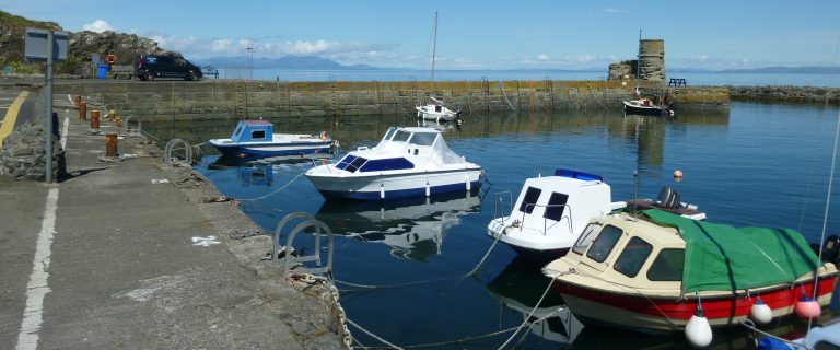
P&O Ferries plies between Cairnryan (near Stranraer) to Larne, north of Belfast, and Stena Line runs between Cairnryan and Belfast; Calmac plies between Ardrossan and Arran, and between Wemyss Bay and the Isle of Bute. These Scottish ports are all on the Ayrshire Coastal Path.
For details, visit Traveline Scotland, or, for the entire UK, Traveline. For travel from anywhere to anywhere, try Rome2Rio.