| Distance (km) | Ascent (metres) | Number of days | |
|---|---|---|---|
| 344 | 7775 | 12 - 16 | |
| Start: Portpatrick | Finish: Cockburnspath | ||
|
Linked to other Scotland’s Great Trail(s): Annandale Way Berwickshire Coastal Path Borders Abbeys Way Cross Borders Drove Road Mull of Galloway Trail Romans and Reivers Route St Cuthbert’s Way |
|||
Books
Below we list printed maps and/or guidebooks in ascending order of cover price: click image or title for more info. To add or alter any items in this list, please Contact us.
Route type and direction
Linear: Portpatrick to Cockburnspath
Traditionally walked from west to east, crossing the Southern Uplands from the Irish Sea to the North Sea, but this can be reversed.
Overview
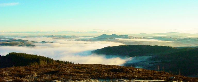
Opened in 1984, the Southern Upland Way is the UK’s first officially recognised coast-to-coast long-distance route. It differs from many other classic walking routes by cutting across the lines of the hills, rather than following the line of least resistance along valleys. It offers superb and varied walking in landscapes that are home to an interesting mix of wild nature and human history, including several ruined abbeys and castles. Due to the remote and sparsely populated area traversed, completing the entire Way is a major challenge. However, it can readily be split into two or three sections (see Public transport, below) and there are various established pickup points, making the route more manageable.
Highlights
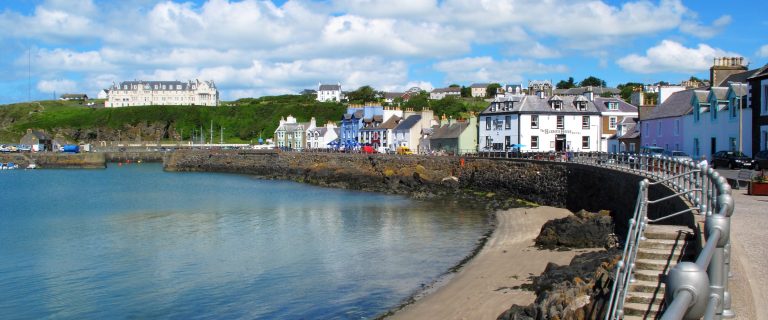
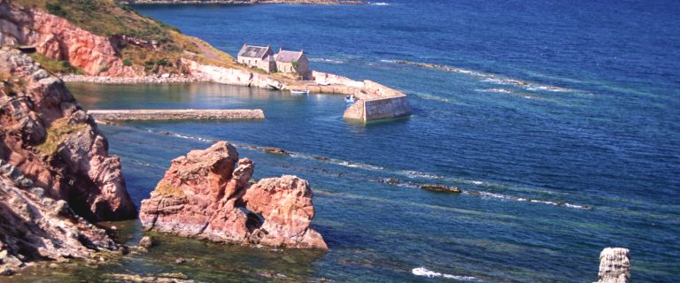
- Portpatrick, with its views across the Irish Sea to the Mourne Mountains
- Rhins of Galloway, with views to the Isle of Man, Ailsa Craig and the Kintyre peninsula
- Galloway and Southern Ayrshire Biosphere
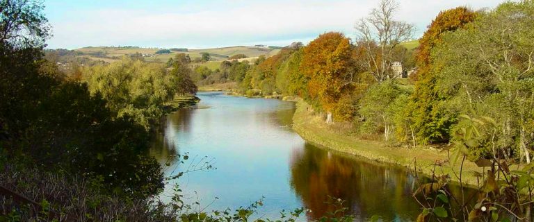
- Loch Trool, St Mary’s Loch and the River Tweed
- Wanlockhead – Scotland highest village at altitude 410m/1350ft
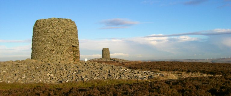
- Views from the Three Brethren – 3 hilltop cairns built in the 1500s
- Traquair House, the oldest inhabited house in Scotland, visited by 27 Scottish monarchs
- Abbotsford House, the home of writer Sir Walter Scott, with his personal and historic treasures
Be aware
- there are some very long, strenuous stretches: be prepared and well equipped
- weather conditions in the hills can change rapidly depending in any season: map-and-compass skills are essential
- if you are wild camping, you will be able to arrange your daily distances to suit your fitness and the load you are carrying
The challenge
Walkers tackling the entire Southern Upland Way in a single expedition should be very fit and experienced. There are some very long, demanding stretches in exposed open upland, so you should be well-equipped and prepared for emergencies. The route is well waymarked, but when visibility is poor you need to be able to navigate reliably with map and compass. The time taken to complete the Way will vary according to individual fitness, season, weather and conditions underfoot. For most walkers, this will fall in the range of 12 to 16 days, although if rest days are included that might stretch to 18 days or more.
The official website is structured on a 12-day itinerary that has 3 consecutive days each of 25-27 miles (40-43 km) which many walkers may find too long. The options for managing this are to split the route into two or three sections and/or to make use of the established pickup points where taxis or B&B hosts will collect walkers who set a more leisurely pace. For example, the listed guidebook splits the route into 14 sections using four pickup points and its longest section is under 19 miles (30 km).
Accommodation
The Way passes through or close to villages and towns with a selection of welcoming B&Bs and hotels. Walkers should plan and seek their accommodation in advance, because places to stay are sparse in some sections of the Way. Information on campsites, B&Bs and hotels which lie on or near the Way can be found by searching the map on the official website. Accommodation is listed also on Scotland Starts Here.
There are also five bothies and various camping options, both at commercial and at free campsites (basic or no facilities). Wild camping is legally allowed in Scotland if practised responsibly under the Scottish Outdoor Access Code. Walkers who carry their own camping equipment can vary their daily distances to suit themselves.
Support services
Public transport
Consult the official website for information about getting to and from the route. In order to walk the Way in sections, you could split it at Sanquhar and Galashiels (using the train) or at Moffat (served by express buses and close to the M74).
For further details, visit Traveline Scotland, or, for the entire UK, Traveline. For travel from anywhere to anywhere, try Rome2Rio.
Downloads
Visit the official website for a range of useful downloads, from an accommodation list to leaflets on history, geology, wildlife and placenames.
| List of downloads | Download |