


| Distance (km) | Ascent (metres) | Number of days | |
|---|---|---|---|
| 38 | 146 | 1 - 2 | |
| Start: Grantown-on-Spey | Finish: Forres | ||
|
Linked to other Scotland’s Great Trail(s): Moray Coast Trail Speyside Way |
|||
Books
Below we list printed maps and/or guidebooks in ascending order of cover price: click image or title for more info. To add or alter any items in this list, please Contact us.
Route type/direction
Linear, between Grantown-on-Spey and Forres
Starting from Grantown (in the south) puts the prevailing south-westerly winds behind you, and means you start 213 m/700 ft above sea level. However, the route can be traversed in either direction, and the official guidebook describes the walk from Forres to Grantown.
For the ambitious walker, this trail can be linked with the Moray Coast Trail and parts of the Speyside Way to follow the 96-mile Moray Way circuit for which Norman Thomson’s Moray Way Companion book is relevant.
Overview
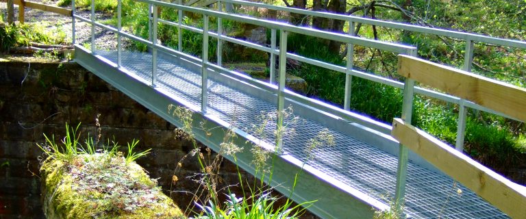
The Dava Way is a walking and cycling path which generally follows the course of the former railway line between Grantown-on-Spey and Forres. After the railway closed (1965) its trackbed fell into decay, and parts were sold off to local estates. The Dava Way Association, based in Forres, was formed in about 1997 and its determined efforts succeeded in acquiring landowners’ consents. After clearing vegetation from the route and building bridges over streams, the Way was opened in 2005.
Highlights
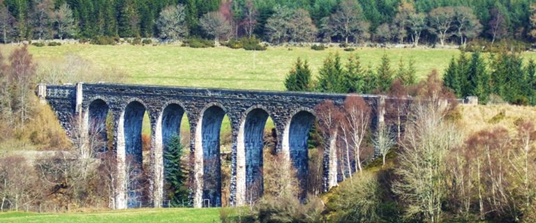
- the Divie viaduct, the trail’s icon, saved from demolition by Lord Laing
- Huntly’s Cave, a gorge where the 2nd Marquis of Huntly holed up in 1645
- Dava summit at 321 m/1052 ft, with a replica of the original sign
- the Breathing Place at DunphaiI, a place to stop, picnic and enjoy nature, near the viaduct
- the Halfway Hut, restored as a shelter and picnic point (with solar panels)
- two wood sculptures: a dragoon near the summit and a collie dog which used to convey messages
Be aware
- Bantrach wood (just south of the viaduct) tends to be wet underfoot
- the turbines of the Glaschyle wind farm, which in many people’s opinion spoils the scenery approaching Bantrach
- the diversion around the Dava settlement, taking cyclists onto the A940 main road for a short distance
The challenge
An old railway line makes navigation easy and waymarking is good at all junctions. There are no severe gradients, but Forres is at sea level and Grantown at 213 m/700 ft, with a climb to the summit at 321 m/1052 ft in between. There are a few muddy sections, and waterproof footwear is recommended.
Accommodation
The Old School House at Dava, which opened as a B&B and Coffee Shop in 2016.
Wild camping is legally allowed in Scotland if practised responsibly under the Scottish Outdoor Access Code.
Support services
The following operator(s) offer a supported tour:
Public transport
A morning and afternoon bus service runs between Forres to Dunphail, but only on school days in termtime. Moray DialaBus (03001 234 565) operates between Forres and Dava. Advance booking must be made no later than the previous day, but standard bus fares apply.
For details of trains and buses, visit Traveline Scotland, or, for the entire UK, Traveline. For travel from anywhere to anywhere, try Rome2Rio.